Erased by Omission: How Barrancos Disappeared From American Maps and What That Loss Reveals About Power, Place, and Belonging
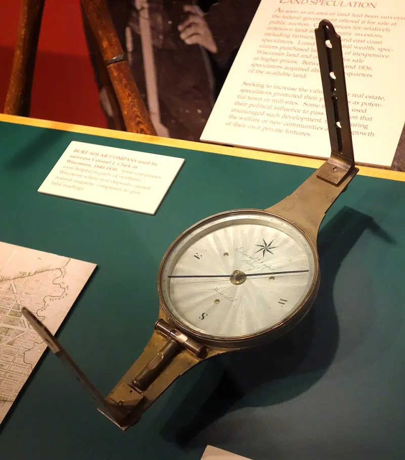
Photo: Daderot, CC0, via Wikimedia Commons
There is a particular kind of absence that speaks louder than any inscription. It is the blank space on a map where a community should appear—the unmarked coordinate, the unnamed road, the settlement rendered invisible by the deliberate or negligent hand of cartographic authority. For the people of Barrancos and their descendants scattered across the United States, that absence is not merely a technical oversight. It is a wound with deep historical roots, and understanding it requires examining who has historically controlled the instruments of geographic record—and who has been systematically left out.
The Map as an Instrument of Authority
Cartography has never been a neutral discipline. From the earliest colonial surveys to the federally commissioned maps of the nineteenth and twentieth centuries, the act of naming, measuring, and recording geographic space has always carried political weight. Communities with access to institutional power—those aligned with dominant cultural, economic, or racial hierarchies—were documented with precision. Communities that existed at the margins of those hierarchies were frequently omitted, misnamed, or absorbed into broader geographic categories that stripped them of their distinct identity.
Dr. Renata Fuentes, a historical geographer who has spent more than a decade studying cartographic representation of minority settlements in the American Southwest, frames the issue plainly. "When a community does not appear on a map," she explains, "it effectively does not exist in the administrative imagination of the state. It cannot receive infrastructure funding, cannot be recognized in legal proceedings, cannot anchor the kind of institutional memory that sustains a place across generations. Omission is never innocent."
For Barrancos, that omission has compounded across centuries. Early Spanish colonial maps recorded the region with varying degrees of accuracy, often prioritizing mission settlements and trade routes over smaller, more isolated communities. As American administrative authority expanded following the mid-nineteenth century, federal cartographers conducting land surveys operated within frameworks that privileged Anglo-American settlement patterns. Communities that did not conform to those patterns—whether due to their ethnic composition, their land tenure arrangements, or their geographic remoteness—were frequently passed over.
A Community That Persisted Without Official Recognition
What makes the story of Barrancos particularly instructive is not simply that it was erased, but that it survived its erasure. Oral tradition, familial memory, and community-maintained records preserved the knowledge of Barrancos' existence even as official documentation failed to acknowledge it. Descendants who grew up in the United States—many of them now living in cities as distant as Chicago, Los Angeles, and San Antonio—speak of learning about Barrancos not from school curricula or publicly accessible archives, but from grandparents, from handwritten letters, from recipes annotated with place names that appeared on no government chart.
Marcela Ríos Castellanos, a third-generation descendant currently residing in Albuquerque, New Mexico, recalls the disorientation of trying to locate her family's origins through conventional research channels. "I would go to the library, I would search the census records, I would look at county maps from the 1880s and 1890s," she says. "And Barrancos simply wasn't there. It was as though the place where my family came from had been decided, by someone with a pen and a surveyor's chain, not to matter."
That sense of institutional dismissal is not unique to her family's experience. Historians who study the administrative treatment of Hispanic, Indigenous, and mixed-heritage communities in the American West have documented a recurring pattern in which smaller settlements were either absorbed into neighboring municipalities on paper—regardless of their residents' wishes—or simply left unrecorded because they did not generate the kind of taxable economic activity that made documentation worthwhile to federal and territorial authorities.
What Cartographic Erasure Actually Costs
The consequences of geographic omission extend far beyond symbolism. When a community does not appear on official maps, it loses access to a cascading series of institutional recognitions. Property disputes become harder to adjudicate. Heritage preservation funding—which frequently depends on a location's documented historical significance—becomes inaccessible. Tourism infrastructure, which can sustain local economies and amplify cultural visibility, cannot be directed toward a place that does not officially exist.
Perhaps most critically, the absence of a community from the cartographic record distorts the broader historical narrative. When American students and scholars examine maps of the Southwest, they encounter a landscape that appears to have been shaped almost exclusively by the forces and settlements that official records chose to acknowledge. The communities that were omitted become invisible not only in administrative terms but in the cultural imagination—contributing to a collective misunderstanding of who actually built, inhabited, and shaped these regions.
Professor James Whitmore, who teaches American historical geography at a university in the Southwest, argues that this distortion has lasting pedagogical consequences. "We teach students to read maps as objective documents," he notes. "But a map is a political artifact. When we show students a nineteenth-century survey map that omits a community like Barrancos, we are implicitly teaching them that that community did not exist or did not matter. Correcting that requires not just adding a dot to a map, but fundamentally rethinking how we present geographic authority."
The Work of Reclamation
In recent years, a growing movement among Barrancos descendants and allied researchers has begun the painstaking work of cartographic and historical reclamation. Volunteer archivists have cross-referenced land grant documents, ecclesiastical records, and privately held family correspondence to establish the geographic coordinates and historical boundaries of Barrancos with a precision that official records never provided. Digital mapping tools have allowed community members to collaboratively annotate geographic databases, inserting the place names, settlement boundaries, and historical landmarks that federal cartographers once chose to ignore.
This work is not merely corrective. It is, in a meaningful sense, constitutive—an act of community self-definition that asserts the right of a people to determine how their place is represented. When descendants contribute their family's knowledge to a shared geographic database, they are not simply filling in a blank on a map. They are asserting that their ancestors' lives and labors were real, that the land they occupied and shaped carries their imprint, and that no administrative decision to omit them from the official record can erase the truth of their presence.
What Barrancos Teaches the Rest of Us
The story of Barrancos' cartographic erasure is, in microcosm, the story of how power operates through the instruments of documentation. It is a reminder that the maps we inherit are not neutral reflections of reality but active constructions shaped by the priorities, prejudices, and administrative conveniences of those who made them.
For communities across the United States that have experienced similar forms of geographic and institutional omission—whether African American settlements erased by mid-century urban renewal, Indigenous territories rendered invisible by colonial land surveys, or immigrant enclaves absorbed without acknowledgment into the surrounding urban fabric—the experience of Barrancos offers both a cautionary history and a model of resilience. Communities can survive their erasure. They can document their own existence. And they can, with sufficient determination and collective effort, reclaim their place—literally and figuratively—in the American geographic imagination.
At Barrancos Heritage, we believe that understanding how this erasure happened is the first step toward ensuring it does not continue. The geography of silence is not inevitable. It is a choice—and it can be unmade.